 By admin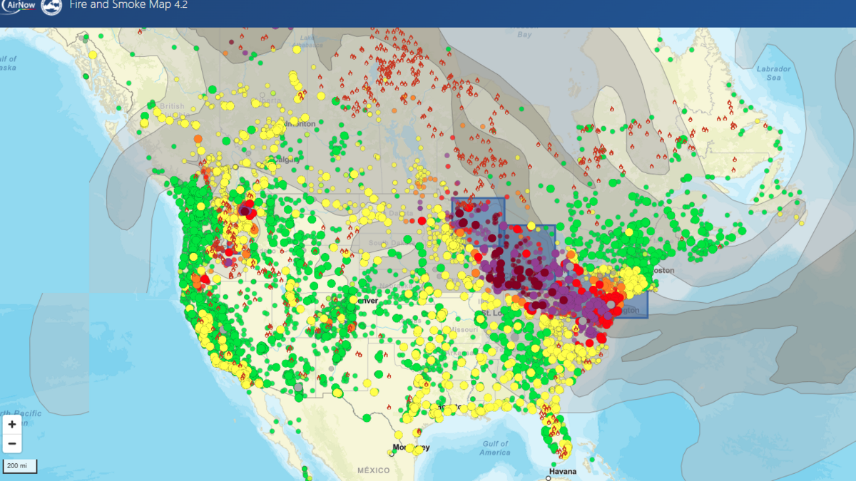
AI-generated summary reviewed by our newsroom.
Read our AI Policy.
- Nearly 900 wildfires in Canada burned nearly 7 million acres and sent smoke to the U.S.
- Wildfire smoke’s PM2.5 fine particles caused over 160,000 U.S. deaths in 15 years.
- Multiple agencies track fires and air quality, including NCFS, EPA AirNow, NOAA, and DEQ.
Almost 900 wildfires in Canada have burned nearly 7 million acres of land, sending smoke down into the United States this week.
Read more Double-decker Amtrak trains in California and the West are going extinct. Here’s why
The number of acres consumed by wildfires across the North America have dramatically increased in recent years, with a record-breaking number of wildfires in Canada in 2023 and 2025.
Wildfire smoke is made of a mix of pollutants, including fine and small particle pollution called PM2.5, one of the most dangerous forms of air pollution with prolonged or extreme exposure. Studies have shown that the increase in wildfires have stopped or reversed the gains made in air quality since the Clean Air Act in some states, and that fine particle pollution in wildfire smoke caused more than 160,000 deaths in the United States over 15 years.
Read more Sac State releases men’s basketball schedule. Who’s back for Mike Bibby’s squad?
Here area number of resources you can use to track air quality reports and wildfires.
- NOAA’s Office of Satellite and Product Operations provides a fire and smoke hazard map: ospo.noaa.gov/products/land/hms.html#maps
- The federal government’s Wildfire Enterprise Geospatial Portal tracks wildfires in the states: egp.wildfire.gov/maps
- The U.S. Environmental Protection Agency’s AirNow’s fire and smoke map shows air quality ratings, fires and smoke plumes: fire.airnow.gov
- The National Weather Service releases fire hazard forecast maps for fire watches and warnings: weather.gov/fire.
- IQAir, an Swizerland-based technology company that works to improve air quality, has a global map showing air quality: iqair.com/air-quality-map
This story was originally published July 17, 2026 at 11:35 AM with the headline “Use these maps and tools to track wildfire smoke’s impact across the US.”
Read more Weird and wonderful at CA State Fair: 3 unexpected must-see exhibits at Cal Expo