 By admin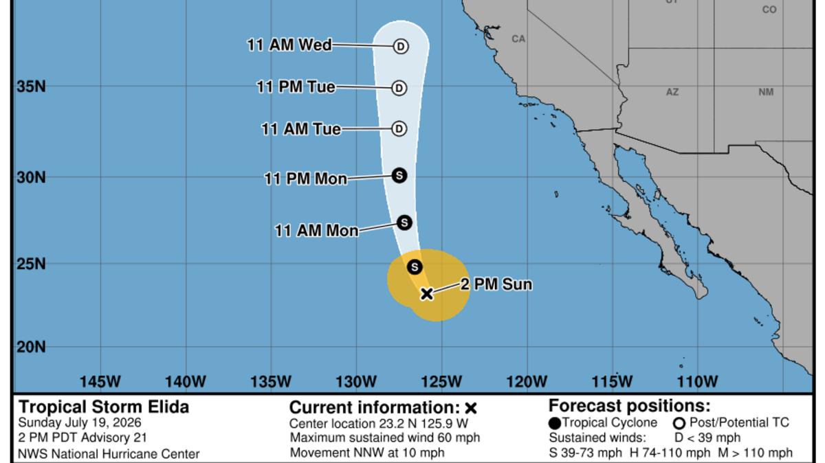
It is not often that tropical storms and hurricanes make their names known to California and the Western U.S., but on rare occasions these severe storms can lash the Pacific Coast with strong waves and even spur rare thunderstorms.
Read more Who was Elinor Steffy? Friends, students remember teacher killed in Folsom crash
Tropical Storm Elida, which will be weakening well offshore as it moves north over the next few days, could bring some rain, but most of the state will feel Elida’s presence in the form of more heat and humidity.
Elida brings monsoonal humidity and higher temperatures to California through Wednesday
In part fueled by the abnormally warm waters of a record-strength El Niño, Tropical Storm Elida is now moving over cooler Pacific waters and will weaken into a “post-tropical” cyclone early this week.
But even these post-tropical cyclones carry tremendous energy. Elida is no exception, and as it heads north it’ll drag with it muggy and warmer weather conditions across the state through Wednesday.
Monday, the weather is expected to still be fairly typical for the Central Valley. Expect sunny to mostly sunny skies and average temperatures. That means highs in the low 90s for Sacramento, upper 90s for Fresno and the San Joaquin Valley, and 60s along the coast.
Read more One Los Angeles Chargers Rookie With the Best Chance to Surprise Everyone
You may notice, however, the presence of extra clouds across the region, indicating the monsoonal moisture is building. There is a chance these clouds will deliver light rain for the Bay Area and spots near Santa Rosa later Monday afternoon into Tuesday morning as Elida draws nearer.
By Tuesday, Elida will be approximately one hundred-some miles closer to Central California, and its presence will be felt as the temperatures rise along with the humidity. Low temperatures in the Sacramento area will quickly climb into the mid- to upper 60s for Tuesday and Wednesday mornings, and further into the 70s in Fresno.
Highs will be in the upper 90s to low 100s for most of the Central Valley Tuesday and Wednesday. A few passing clouds from Elida’s moisture could turn into an occasional thunderstorm over the Sierra. These will be the hottest and cloudiest days this week.
Temps will cool down a touch for Thursday and Friday as Elida weakens further and the monsoonal moisture fades. So to recap for those venturing outdoors this week, the main concerns will be stray thunderstorms in the mountains through Wednesday, stronger surf along the coast, and higher air conditioning bills as temperatures rise.