 By admin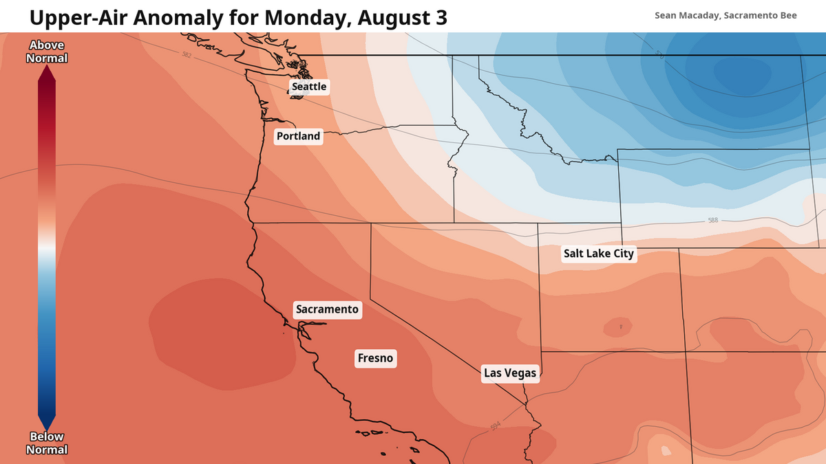
This weekend was, by most accounts and data, the hottest one of summer so far. Temperatures officially peaked Sunday at 103 degrees in Sacramento and 107 degrees in Fresno, with both Saturday and Sunday featuring 100-degree high temps for the entire Highway 99 corridor from Redding to Bakersfield.
Read more The Poverty Line: Millions of Californians are one setback away from crisis
And despite the sweltering weekend behind us, more heat lies ahead. Triple-digit heat will linger almost to next weekend.
High temps have peaked, but heat still lingers
The heat wave this weekend was due to an intense heat dome — a mass of high pressure all the way through the higher altitudes of the atmosphere — peaking over Southern California. For the coming week, that heat dome is slowly flattening out across Northern California as it slowly drifts north.
That means that — despite the heat not going anywhere — temperatures will become slightly more bearable through the next seven days. Monday is another scorcher, with highs around 105 degrees from Sacramento to Fresno. A heat advisory is still out through the southern San Joaquin Valley including Merced and Fresno through 11 p.m. Monday.
By Wednesday, we will start to feel (relatively) cooler air sinking in. Some highs will fall below 100 degrees near the Delta as the Delta breeze softly returns for Sacramento and Modesto
By the weekend, high temps will be flirting with 100 degrees here and there, especially for places like Merced, Fresno and Redding, but the marginal improvement will begin to be a bit more noticeable as the heat dome continues to weaken to the north.
Read more Why Sacramento dropped a youth violence program that worked. Here’s what to know
Smokey skies possible later this week
As the heat dome moves north, it will send some smoke from Oregon and Washington wildfires south towards California.
The magnitude of smoke and air quality concerns later this week is difficult to discern at this moment, but it is reasonable to expect deteriorating air quality as the weekend nears. This will be especially true for the Central Valley, which will increasingly catch much of this smoke as the week progresses. While heat normally improves overnight and in the mornings, wildfire smoke and its air quality effects will linger all day when they arrive.
That north breeze will also pose an increased risk for wildfires, especially on the eastern foothills of the coast range where those north winds could gust up to 30 mph during the evenings over the next few days. As of late Sunday, the Feliz Fire in Mendocino County near Hopland had reached 872 acres — and wildfire concerns will grow stronger in that area over the coming days.
Cool down won’t arrive until next week at earliest
The heat dome will likely dissipate next week as the atmosphere works to normalize, marking the end of the hottest stretch of summer so far. For the Central Valley, high temperatures are likely to return to average, meaning widespread 90s for much of the region.
Read more Is it legal for CA drivers to pass bikes on the road? Here’s what state law says