 By admin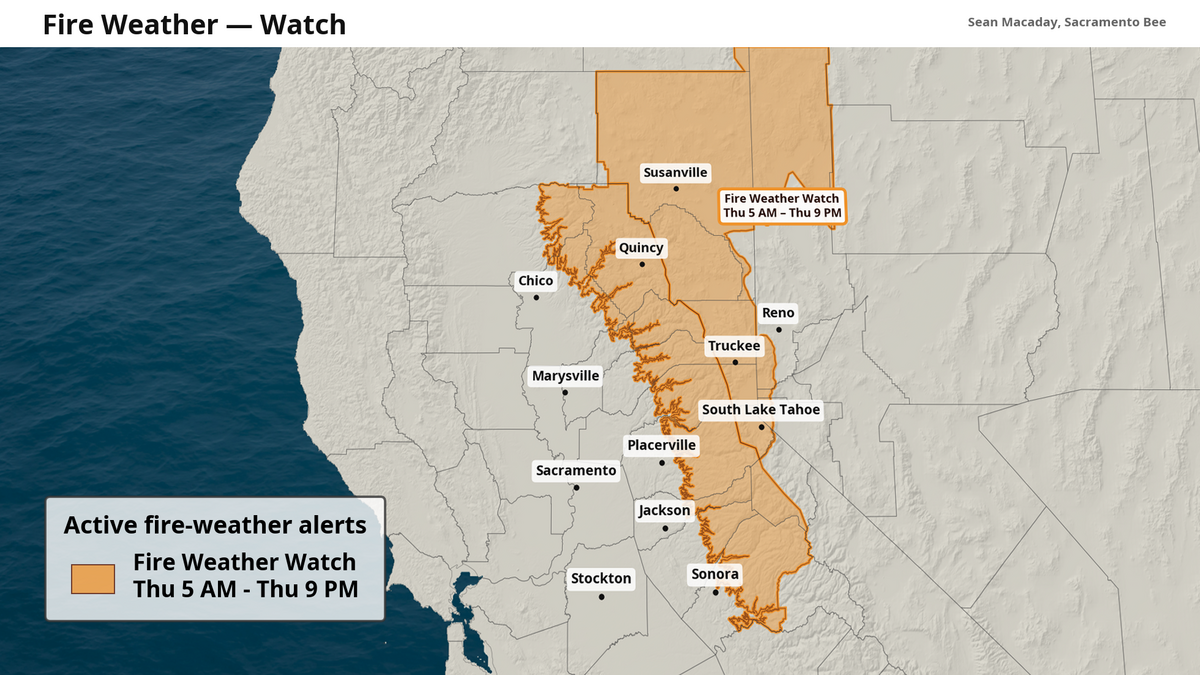
The National Weather Service has issued a fire weather watch for the Sierra between early Thursday morning and late Thursday evening ahead of an inbound window of strong wind gusts and the potential for mountain and desert lightning.
Read more NFL Fans Predicting Political Career For ESPN’s Pat McAfee
A fire weather watch signals that conditions are potentially favorable for the quick spread of wildfires. In this case, a critical risk for fire comes from the forecast rapid onset of strong outflow winds gusting above 30 mph, coupled with the potential for lightning.
The area affected extends from Tuolumne County north to Lassen County, and covers elevations above 3,000 feet.
On Wednesday, an upper-level trough — a bundle of lower pressure through the upper atmosphere — will push across Central California. It will bring about cooler temperatures and widespread clouds for the Central Valley, and create sporadic thunderstorms over the Sierra and high desert as it collides with monsoonal moisture from Arizona.
These unseasonable conditions will largely persist on Thursday as high temperatures remain below average for most of inland California and more isolated to scattered thunderstorms emerge Thursday afternoon. These thunderstorms pose the greatest wildfire risk.
Read more Mason Mount Injury a Clear Reminder of What Man Utd Must Still Do
Bug Fire continues to grow north of Reno
The mix of windy and stormy conditions Thursday will come at a poor time for a nearby fire that exploded along the California-Nevada border over the weekend.
The Bug Fire just north of Reno had grown to over 44,000 acres as of Tuesday afternoon, and is only 4% contained. Much of the fire is on the Nevada side of the border, close to Cold Springs and portions of the Reno metro area. Winds could hinder efforts to contain the fire, and more lightning-sparked fires could exhaust resources further.
Cooler temps here to stay this weekend
This bout of clouds and mountain storms will leave in its wake a much-needed reprieve from the intense heat for much of inland California. While the past weekend saw high temps soar to near 110 degrees in the Central Valley, with overnight lows as high as the 80s, this weekend will almost feel like a different season.
High temperatures all weekend long will hold steady in the mid-80s for the Delta region of Sacramento and Stockton, and only be a touch warmer for Modesto. Further north and south in the Central Valley, highs in the 90s will still be a welcome change for everyone looking to get out this weekend before school is back in session.
Read more George Kittle’s Projected 49ers Week 1 Return Is Starting to Look Realistic