 By admin
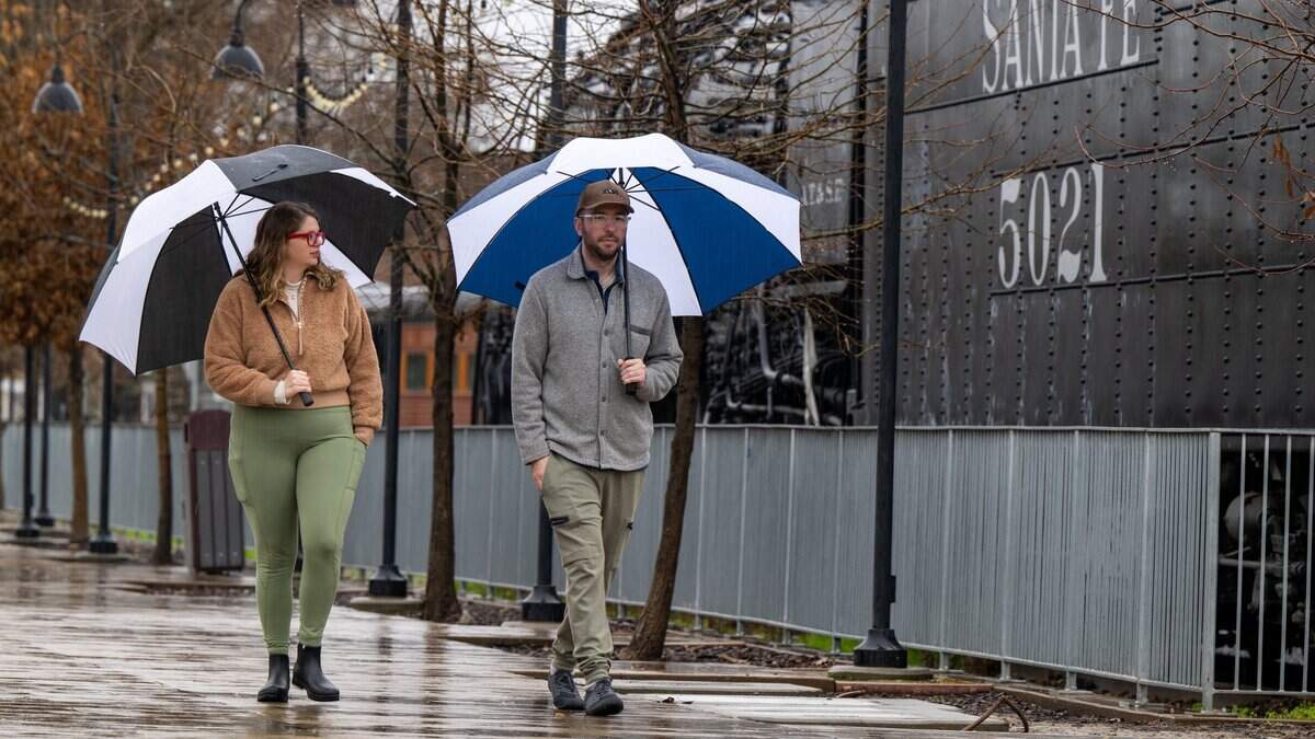
Multiple rounds of rain-soaked atmospheric rivers will push across the Golden State this weekend, bringing rains, wind, rising tides and even snow at elevation, as California begins to feel the influence of this season’s record El Niño.
Read more German cockroaches and rodent droppings at East Sacramento brunch spot. What else
To touch on the wind before diving into the expected rain, gusts will be strongest on Friday through the evening as the first atmospheric river arrives. They will blow at speeds of up to 35 mph out of the south from Sacramento to Fresno and across Southern California. It will make an already wet and cooler day a straight-up blustery one. Gusts will be even stronger, up to 50 mph, at elevation and in areas along the coast.
The winds will also drive intense surf towards the coast. A high surf warning is in effect through Sunday morning from San Luis Obispo to Eureka as waves of up to 35 feet are expected as the drenching rains arrive.
Season’s first atmospheric river for Northern and Central California
While there was a brief atmospheric river across Southern California and the southwestern U.S. around Halloween, this will be the first to truly soak the entire state.
As cool air from Alaska continues to sink down along the coast, it rapidly saturates the subtropical jet stream with abundant moisture, in part thanks to El Niño. As the jet stream saturates, it becomes a moving stream of rain stretching thousands of miles across. In this case, it will stretch along the entire West Coast and out to sea.
Rain was expected to begin in the early morning hours Friday across Southern California and along the Northern California coast as the first few showers ahead of the atmospheric river push through. Those showers were expected to be brief, enough to wet pavement.
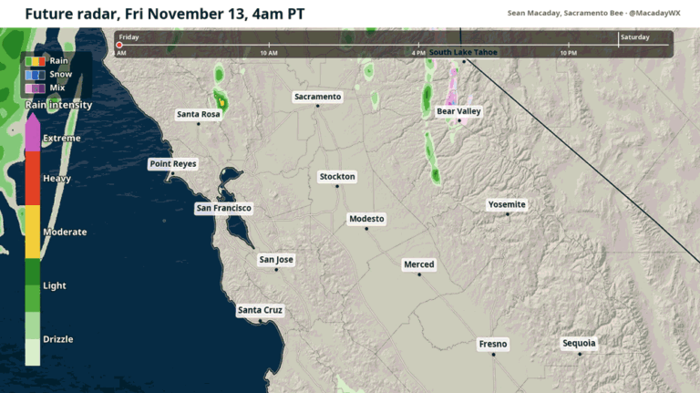
That is expected to change in Northern California after 7 a.m., as a line of heavier showers and even a few thunderstorms push inland along the north Coast Range and the Sacramento Valley.
Heavier and longer-lasting showers should arrive in Sacramento around 10 a.m. and linger through the afternoon. Further south, showers continue across the Central Valley through the whole afternoon in Modesto, Merced and Fresno. Most rains across the San Joaquin Valley will begin to die out between 7 p.m. to 10 p.m. as a lighter sporadic drizzle.
In Southern California, the atmospheric river will be shorter-lived, bringing only a few hours of sustained rain to San Luis Obispo and Los Angeles in the afternoon before drying out.
Read more Sacramento Japanese restaurant has fifth break-in, claims lack of police support
Around half an inch of rain is expected to fall across the Central Valley on Friday and Saturday, with another quarter to half inch possible later Sunday into Monday as the second wave hits. Rain totals are expected to be higher along the coast, with significantly more along the northern coast and at higher elevation, where the atmospheric river will be felt as substantial snow accumulation.
Second wave of rain late Sunday into early Monday
After a drier Saturday, with partly sunny skies and highs in the 60s across most of the state, rain will return Sunday afternoon and last into Monday.
The atmospheric river arriving on the West Coast on Sunday is expected to be a tad weaker than its Friday counterpart. A slow-moving line of showers will push through the Sacramento Valley and Northern California on Sunday afternoon with winds gusting up to 20 mph. The showers will push southeast towards Modesto overnight, and further south into Merced, Fresno and San Luis Obispo by Monday morning.
By the time skies clear later Monday, a fresh coat of snow will have fallen across the Sierra. A winter storm warning is effect through Tuesday morning in the Sierra, with snowfall accumulations up to 2 feet. The first half of this snow falls with the atmospheric river on Friday, with more falling Sunday night into Monday. Roads will remain slick across mountain passes well into next week, and chains are a good idea if heading above 6,000 feet.
More atmospheric river action later next week
As El Niño continues to provide abundant moisture and unstable air to the south, any atmospheric rivers that develop will be supercharged, with more rainfall and stronger winds to keep storms going longer.
And when the atmosphere is set to do something once, it is often set to do it again. This will be the case later next week, when another atmospheric river could batter the Golden State between Wednesday and Friday. The Climate Prediction Center is already signaling a wet pattern set to develop between Nov. 17-21.
This story was originally published November 13, 2026 at 6:00 AM with the headline “Atmospheric river arrives in California with rain, wind. Here’s how much is coming.”
Read more Another Alex Trebek ranch is up for auction in California. The last one sold for $16.9M