 By admin
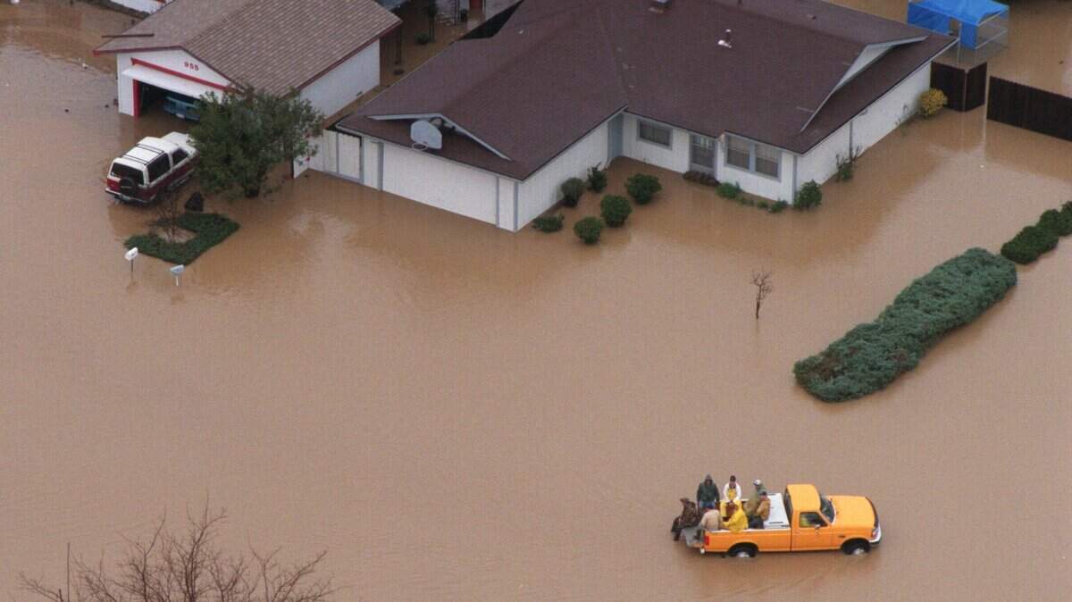
From earthquakes to wildfires and floods, California is prone to many natural disasters.
Read more Highway 50 in El Dorado County is a hot spot for wildlife road deaths. What to know
California saw a total of 8,232 wildfires in 2025, according to the California Department of Forestry and Fire Protection.
These blazes burned more than 500,000 acres of land, destroyed 16,000-plus structures and resulted in 31 deaths, Cal Fire said.
So far in 2026, more than 6,400 wildfires have collectively scorched upwards of 339,000 acres.
California experienced nearly two dozen “significant” earthquakes of magnitude 3.3 or higher in 2025, the U.S. Geological Survey said, with 10 notable quakes reported so far in 2026.
Is California prepared for widespread threats? How does the state warn residents about natural disasters?
Here’s what to know:
Which are the risks of natural disasters in California?
More than 15,000 earthquake faults run through California, which is part of the Ring of Fire along the Pacific Rim.
“These faults lead to a great deal of seismic activity, making California the second most seismically active state,” said the California Residential Mitigation Program, which helps California homeowners strengthen their homes against earthquakes through grant retrofit programs.
Wildfires are a common occurrence in the Golden State due in part to weather and climate change.
California’s dry, warm weather can result in plenty of parched vegetation, providing fuel for major fires as strong winds whip the flames.
Meanwhile, the state’s growing population poses a higher potential for blazes sparked by human activity.
Other threats facing Californians include flooding and mudslides.
The California Department of Water Resources reported that at least one flood event has occurred in all 58 counties in the state in the past 25 years, resulting in the loss of dozens of lives and billions of dollars in damage.
“When California experiences large winter storms that bring heavy rain,” landslides can move large amounts of material that can threaten lives, block roads and destroy homes, the state Residential Mitigation Program said.
How prepared is California for natural disasters?
The was signed into law in 1970 by then Gov. Ronald Reagan.
The act, which is designed to ensure the state is prepared when disaster hits, established the Governor’s Office of Emergency Services.
It also gives the governor complete authority over all state government agencies when a state of emergency is declared.
In the event of an emergency, the state has set up a chain of command to , according to the 2024 California State Emergency Plan.
The National Weather Center collaborates with the Federal Emergency Management Agency to issue the first state warning to the California State Warning Center, which then communicates the message to statewide and regional departments and agencies.
The state emergency plan says state and local agencies and authorities are required integrate plans and coordination prior to emergencies to ensure a “more effective response and recovery.”
The created a four-phase plan in 2020 to aid local agencies on how to prepare and respond to regional climate threats.
The guide highlights steps to identify the reasons to create a plan, assess vulnerabilities that could affect communities, define strategies and implement and monitor the program.
Read more How do you navigate a flooded highway? Driving tips as Sacramento faces heavy rains
Which policies protect residents during natural disasters?
California uses the Standardized Emergency Management System to maintain multiple agencies in response to emergencies.
The system has five levels that can be activated in the case of a major disaster or threat, ranging from the field to state level.
Requests for support start at the local levels up, as resources flow from the state level down.
The California Governor’s Office of Emergency Services stated that local jurisdictions need to have a plan in place for .
Counties should partner with multiple transportation providers to secure 24/7 emergency services if needed.
This can include offering hotel shuttles, airport rental cars and taxis free of charge to state residents needing emergency evacuation services.
California also assigns state government departments to help local jurisdictions including:
- California Department of Transportation
- California Business, Consumer Services and Housing Agency
- California Highway Patrol
- California Department of Transportation
- California Department of Food and Agriculture
- California Health and Human Services Agency
- California Department of Developmental Services
- California Department of Rehabilitation
- California Department of Social Services
- California Emergency Medical Services Authority
- California Department of Public Health
Is California prepared for a statewide terrorist attack?
“Cyberattacks and terrorism from state and non-state actors remain a serious threat to California’s government operations, its people, and its critical infrastructure,” the California State Emergency Plan said.
The California State Threat Assessment Center partners with public safety agencies to share resources and information. The center is composed of cyber analysts and experts in defense, response, information technology, cybercrimes and forensics.
President Donald Trump suggested Iran could “take out” Los Angeles and San Diego at a rally in Nebraska on Oct. 6, Reuters reported.
In response, Gov. Gavin Newsom posted on X that he was “directing the State Threat Assessment Center to actively monitor the situation in the event that foreign actors interpret the president’s remarks as an invitation to target California.”
The California State Threat Assessment System is in place to prevent, investigate and respond to terrorist attacks.
The department spearheads communications to state and local agencies to inform and aid against threats and public safety concerns.
Is my home at risk of flooding? Wildfires?
To determine if you live in an area at risk of flooding, check out the Federal Emergency Management Agency’s Flood Map Service Center.
You can search by address, place or coordinates to see if you’re in a high-risk flood zone.
Cal Fire maps fire hazard severity zones falling into three different tiers: moderate, high and very high.
You can find fire hazard maps for specific California counties or check out statewide maps.
Watch Duty lets you track active wildfires in the state.
The California Department of Conservation has interactive maps to find locations across the state that are susceptible to deep-seated landslides and earthquakes.
Read more He faked records on 265,000 ‘ghost cattle’ and stole $244M. He wants clemency