 By admin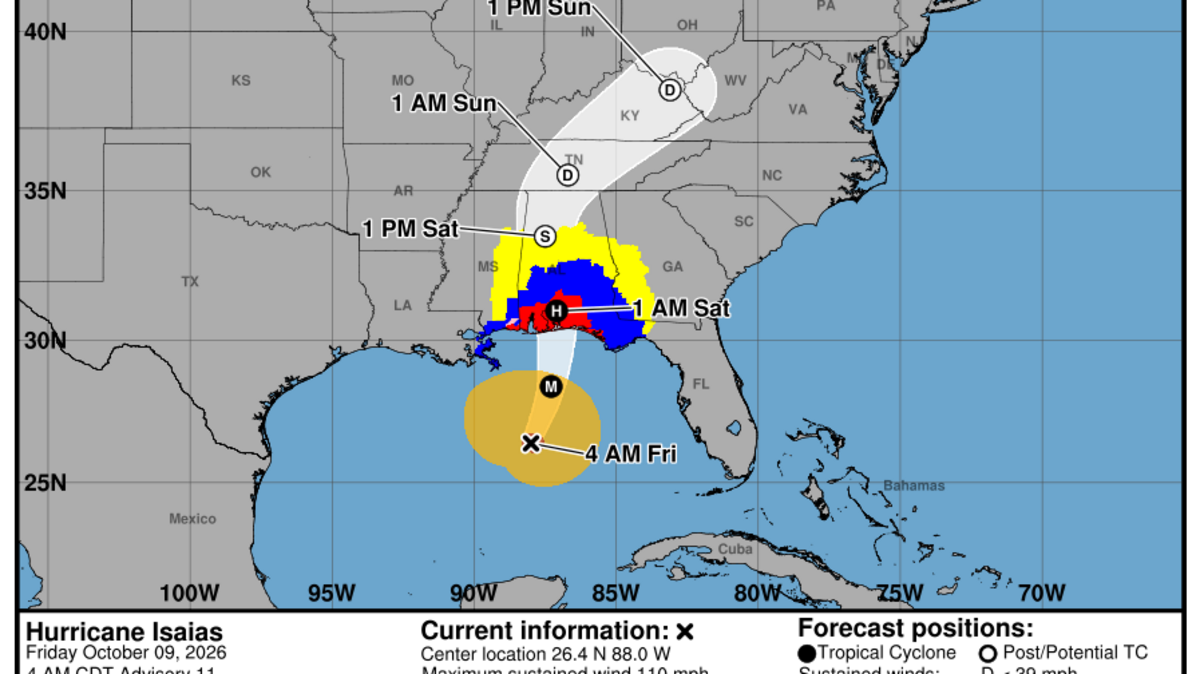
Hurricane Isaias is now a major Category 3 hurricane ahead of an expected landfall in the Florida Panhandle Friday evening — bringing 100-plus mph winds, up to 7 feet of storm surge and the potential for double-digit rain.
Read more Who is Jonathan Newell, the Broward student accused in Cornell rape?
The Panhandle remains blanketed in storm watches and warning, with mandatory evacuations underway in several counties and a state of emergency declared in 25 counties. On Thursday, Gov. Ron DeSantis urged Floridians to be aware of the storm, particularly the higher-than-usual risk of tornadoes,
The National Hurricane Center said at 8:20 a.m. Friday that Isaias had 120 mph maximum sustained winds, a Category 3 storm.
For days, forecasters have predicted that a wall of wind shear near the northern Gulf coast would help cut the storm down just before landfall, bringing slightly lower winds but a broader storm ashore. However, on Friday morning the hurricane center noted that the timing matters a great deal.
Read more Nicolás Maduro and wife charged with ordering torture of Americans in Venezuela
“This is a tenuous spot because it would only take about a 6h delay in the onset of the shear to bring a stronger hurricane than expected onshore,” forecasters said at 5 a.m.
Hurricane Isaias is expected to make landfall near Pensacola late Friday or early Saturday, but its high winds and heavy rains — as well as tornado risk — extend far outside the direct landfall area. The hurricane center predicts 4 to 8 inches of rain for the Panhandle, or up to 15 inches in some spots.
This story was originally published October 9, 2026 at 4:40 AM with the headline “Hurricane Isaias hits Category 3 as it closes in on Florida landfall.”
Read more He represented women accusing mogul Ethan Conrad of sex assault. Now woman is suing him