 By admin
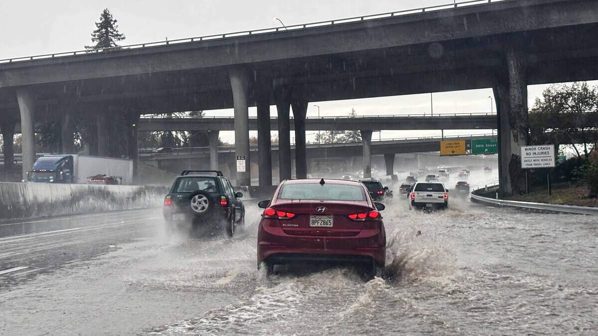
The rain this weekend might be a tiny appetizer for what is to come for the rest of the month.
Read more ICE pepper sprayed pregnant U.S. citizen, put her on ground in California, lawyer says
As a record El Niño looms large and threatens California with immense precipitation this winter, its influence is already being felt as extra moisture falling across the Golden State.
An atmospheric river Friday — the first of the season for Northern California — dropped over an inch of rain across portions of the Sacramento Valley and Coast Range as a line of steady showers, and even a few rumbles of thunder, rolled inland from the sea. Rainfall totals less than an inch fell in the San Joaquin Valley and Southern California. Thirty foot waves rocked nearly the entire California coast, and up to a foot of snow fell in the Sierra.
And that was only Friday. A second and lighter round of atmospheric river rain rolled into NorCal on Sunday night and will continue marching south through Monday, with a third and fourth round of rain in the forecast through the rest of the week and several more storms to come heading into Thanksgiving.
Showers continue Monday
As of Monday morning, a messy line of showers continues to move from Northern California south into Southern California. The band of showers is likely to arrive between Fresno and San Luis Obispo around noon Monday, and slowly continue pushing east through the rest of the day. Sacramento will stay mostly dry through the rest of Monday as the steady showers push southeast, although a few brief drops are likely towards the foothills here and there.
Monday’s showers will be slower moving than Friday’s, allowing more rain to accumulate despite the showers being weaker than those on Friday. Up to another half an inch of rain is in the cards.
Meanwhile, lighter snow will continue to pile up in the Sierra into early Tuesday morning, with already up to a foot of snow reported mid-mountain at Palisades Tahoe as of Sunday.
Tuesday will be calm — mostly sunny skies and light winds will make for the best day to get outside this week, with widespread high temperatures in the low 60s and upper 50s.
The next storm arrives on California’s shores later that night.
Drenching rains, thunderstorms return Wednesday
The third storm system in a week is poised to be the strongest yet for the state. As more cold air from Alaska tries to dig deeper into a jet stream flush with moisture, in part boosted by El Niño, the result will be a rapidly deepening area of low pressure that unleashes the atmosphere on Central California.
Read more How much rain fell in Sacramento? See 72-hour rainfall totals across region
Aided by a cut-off atmospheric river, a potent cold front will interact with deepening low pressure to produce a line of long-lasting rain, winds gusting to 35 mph, thunderstorms and mountain snow. The storm arrives across Northern and Central California Wednesday throughout the day, and expands into Southern California overnight into Thursday.
As the central pressure of the winter-like storm drops lower and lower Thursday, winds will continue to grow stronger and squeeze out more subsequent moisture. The resulting rainfall totals are likely to be greater than those observed over the past few days, with widespread amounts greater than two inches across the Sacramento Valley and coast, greater than an inch in the San Joaquin Valley.
This third storm system is set to peak Wednesday night and Thursday morning across the Central Coast and in the Sierra as it attains its maximum strength. Rainfall totals exceeding 3 inches will stretch from Monterey Bay south along the Central Coast to San Luis Obispo.
Meanwhile in the mountains, the combination of cooler temperatures and a deepening area of nearby low pressure will allow for a period of potentially extreme snowfall. Essentially, as a front begging to form right along the Sierra ridgeline in a moment of “mountain frontogenesis,” conditions will be perfect for snow to pile on above 5,000 feet. The result of this would be several feet of snow falling from Lake Tahoe south to Mammoth Lakes in less than 48 hours. A winter storm watch is already out for the Sierra through Friday morning, and is likely to be upgraded to a winter storm warning as this third storm draws near.
A train of storms through the rest of the month
All of this looks like it may only be just the start of what is likely to be a very long winter.
The upper atmospheric pattern is set to be stuck in this position for the next two weeks, setting up a parade of atmospheric rivers and winter storms rolling across Northern and Central California for seemingly the rest of the month, with storms reoccurring every few days on the way to Thanksgiving. The fourth float in this Thanksgiving parade of storms is set to arrive this weekend, with a fifth and sixth before Black Friday.
Some conservative rough projections for the next two weeks could be dramatically wetter than normal. Precipitation through Nov. 29 could be up to 500% of normal across the central two thirds of the state. The Central Valley typically sees roughly an inch of rain during the second half of November. The area could see 3 to 5 inches on top of the rain that has already fallen this month.
This story was originally published November 16, 2026 at 5:30 AM with the headline “Soaking California storms continue this week. How much rain to expect and when.”
Read more Could California reading reforms match Mississippi’s gains? Lessons from ‘miracle’