 By admin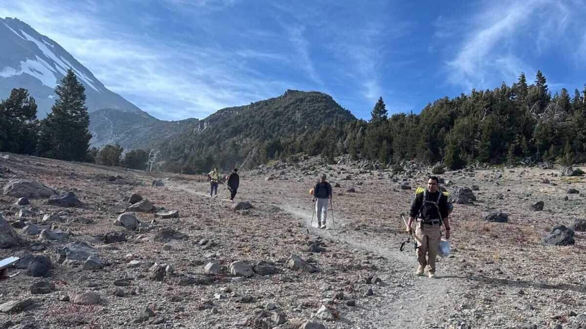
Three rookie Roseville hikers turned to artificial intelligence to help plan their climb of Mount Shasta. They ended up needing actual humans to rescue them.
Read more Intel reverses course on Folsom campus, will take real estate off the market
The three men were safe Monday after U.S. Forest Service climbing rangers and Siskiyou County search-and-rescue volunteers reached them in a mountain canyon, according to the Siskiyou County Sheriff’s Office.
Trouble began during their descent Sunday night from the Shasta summit, when a late start, a wrong turn, an injury and what sheriff’s officials described as an overreliance on an AI assistant forced the hikers to spend the night in dangerous Mud Creek Canyon.
The trio had relied heavily on Google’s Gemini AI for advice about their route and how much food and water to pack for what they expected would be an eight-hour climb to the summit.
The chatbot’s advice did not age well once eight hours turned into an overnight rescue.
“This was a critical misstep,” the Sheriff’s Office said in a statement announcing the hikers’ safe return. “They were advised by Gemini to bring far less food and water than their group required, especially when their planned 8-hour ascent became a multi-day ordeal.”
Sheriff’s officials said hikers should contact the U.S. Forest Service ranger station at Mount Shasta for current conditions and trip-planning information before setting out and should never rely solely on artificial intelligence to plan a wilderness trip.
The hike started smoothly Saturday. The three Roseville men made camp at an elevation of 8,400 feet, then set out about 3 a.m. Sunday carrying daypacks for their push to the summit, sheriff’s officials said.
But the schedule quickly became a problem. Rangers recommend hikers observe a noon turnaround time “while you (or a potential rescue party) still have sufficient daylight to hike out,” according to the Sheriff’s Office.
Read more Grammy Award-winning band Weezer kicks off tour at Sacramento’s Golden 1 Center
The hikers did not reach Mount Shasta’s 14,179-foot summit until 7 p.m. Sunday — seven hours after the recommended turnaround time.
Night fell as they made their way down the mountain. About an hour into the descent, the hikers called Siskiyou County dispatchers for directions before veering off-route into Mud Creek Canyon. Their situation worsened later that night when one of the hikers fell and injured a knee in the steep terrain, sheriff’s officials said.
Stranded in Mud Creek Canyon, the three spent the night on the mountain. U.S. Forest Service climbing rangers and Siskiyou County Sheriff’s Office Search and Rescue volunteers reached them Monday morning.
All three hikers and their rescuers returned to the trailhead without incident, the Sheriff’s Office said.
The hikers were fortunate. The roughly 16-mile Clear Creek route up the southeast side of the mountain was considered the easiest route to the peak, according to the Mount Shasta Avalanche Center. Sheriff’s officials cautioned, however, that even hikers taking that route needed to prepare for unexpected trouble, including injuries and unplanned overnight stays.
Hikers also needed multiple ways to navigate up and down the mountain and should regularly check to make sure they remained on the correct route.
“Serious accidents and fatalities occur on the Clear Creek route when individuals become lost and wander into more dangerous terrain, such as the Mud Creek drainage,” the Sheriff’s Office said.
Read more Another grocery item recalled in California. Here’s what to look out for